Electrical Resistivity and IP Surveys
Southern Geophysical has led Electrical Resistivity Tomography (ERT), Induced Polarisation (IP), and Ground Conductivity (EM31) surveys for over two decades
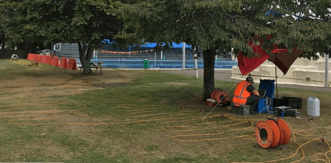
Dual Syscal Terra Switch ERT & IP system for cutting edge surveying
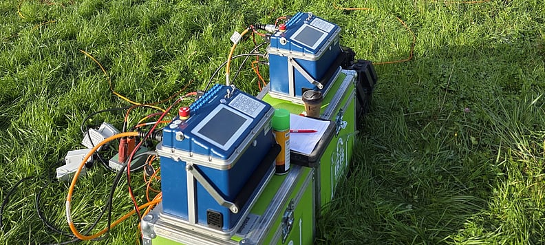
Syscal Terra Switch ERT/IP System
Southern Geophysical have acquired the latest Syscal Terra Switch ERT/IP systems in our ongoing pursuit of fast and accurate surveying, looking ever deeper. We operate two 48 Channel systems which can be tethered together for a total of 96 channels. The benefit of the two systems over a single 96 channel equivalent is the modular nature of the Terra Switch. We can run each of the 48 channel systems on either sides of roads, rivers or buildings and capture data below these features without the need for obstructions or traffic management. The two systems sync via GPS and open up unique surveying opportunities in built up areas that would otherwise be costly or impossible to investigate.
For large scale ERT/IP surveys, common in the mining and resources industry, we can run the Terra Switch in receiver mode with an external high-powered transmitter, allowing us to image many hundreds of metres below ground. With the Terra Switch, we can customise the survey configuration for shallow high-resolution surveying, deeper investigations, or working in coastal and marine environments.
Electrical Resistivity Tomography (ERT)
Electrical Resistivity Tomography (ERT) surveying is a geophysical technique used to identify features in the subsurface by applying a current directly to the ground and measuring the voltage at receiver electrodes. A variety of configurations can be used, tailored to best identify the features of interest and to provide 2D or 3D results as required. Common applications include mapping infilled or voided sinkholes, identifying depth to bedrock, locating mineral resources or potential groundwater targets. Other applications include mapping the size and extents of landfill or locating and delineating leachate plumes.
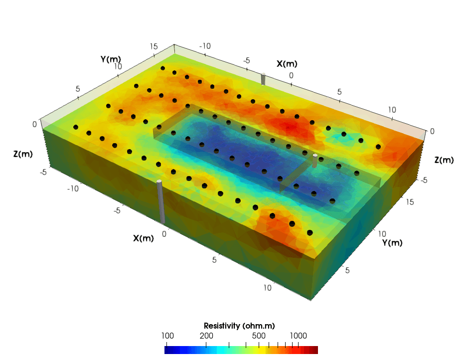
The above image shows the results of a 3D ERT survey assessing the conductivity of a nitrate reducing permeable barrier, prior to saltwater tracer experiments. This survey was the beginning of a complete suite of time-lapse 3D ERT surveys undertaken by Southern Geophysical working alongside Dr Andrew Binley and was initiated by PHF Science (formally known as Environmental Science and Research (ESR)) in their nitrate remediation programme. This work is featured on our Project page PHF Science-Nitrate Mitigation.
Coastal ERT
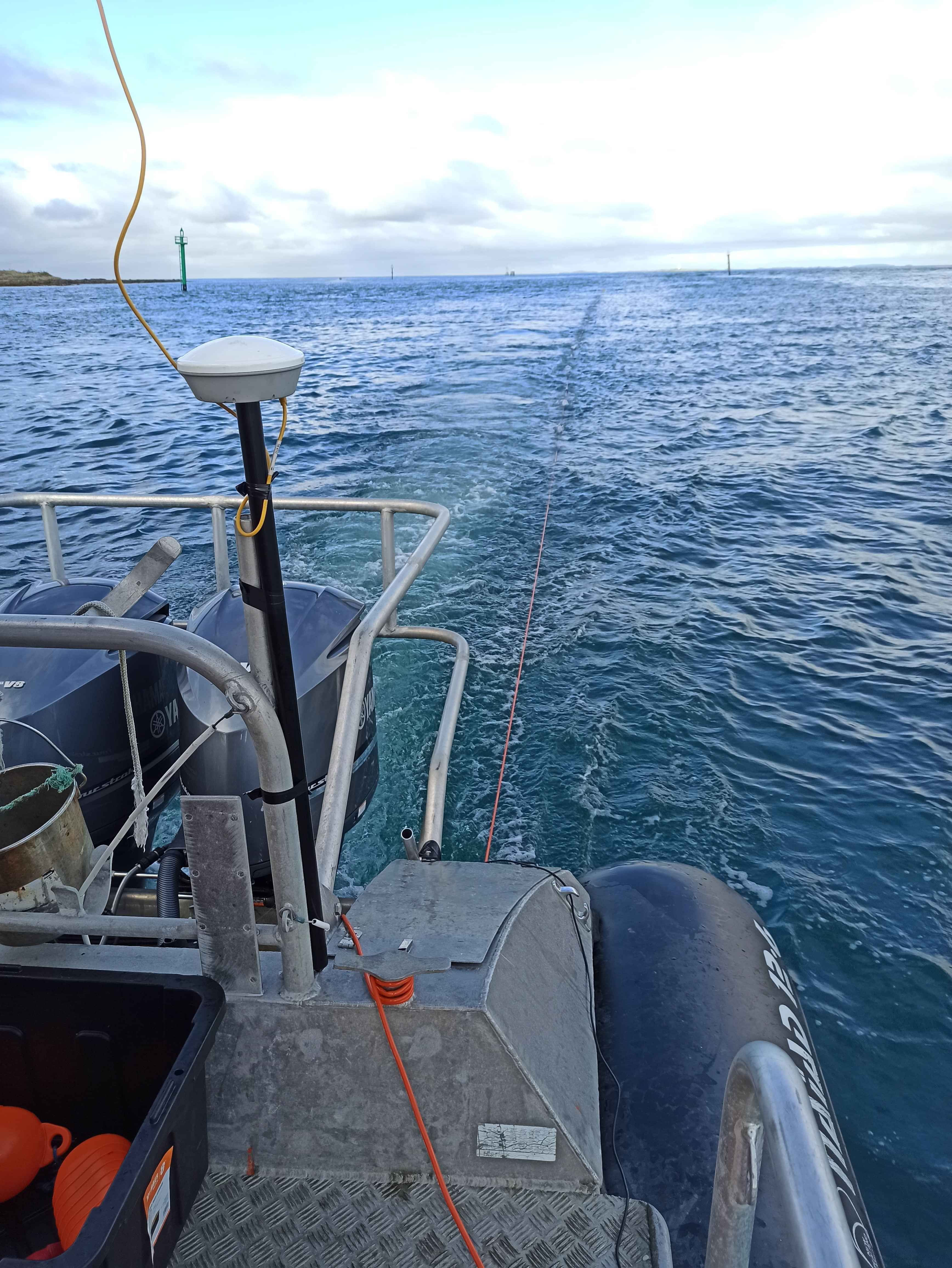
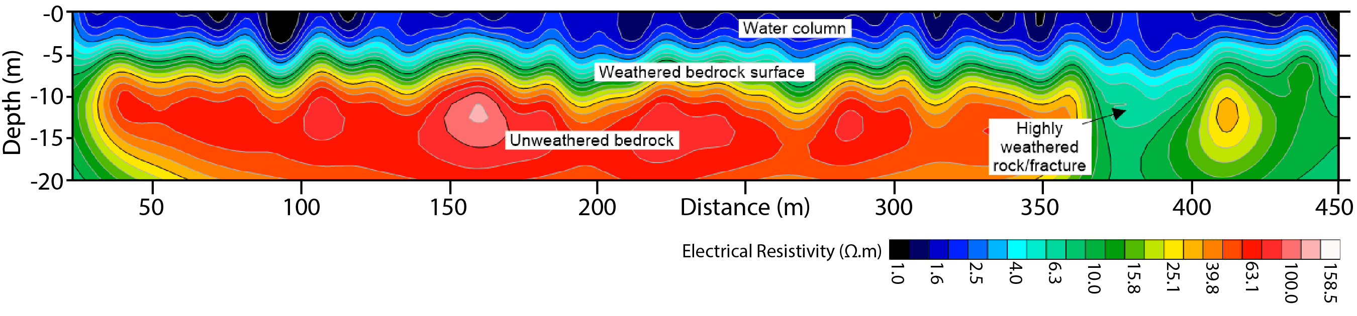
Floating electrode marine ERT surveys can be undertaken off the back of a small boat, capturing GNSS positions and correcting for electrode offset. Bathymetry is captured and applied to the inversion to correct for the conductive water column.
A 2D section is generated showing the water column, bedrock with a weathered/seawater saturated top surface and deeper seated less resistive zones which likely indicate more highly weathered rock, often linked with significant fractures and weaker rock.
Induced Polarisation (IP)
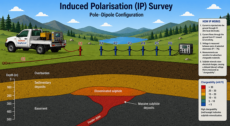
Induced Polarisation (IP) is a survey method which measures the chargeability of materials in the subsurface, such as massive sulphide deposits. These hold a “charge” for a short duration of time, before dissipating, similar to that of a capacitor. A current is directly applied to the ground and the voltage response through time is captured at receiver electrodes.
The most common application for IP surveying is identifying minerals of interest or accessory minerals through their IP response, such as locating potential gold sources by detecting accessory sulphides. Other applications include mapping the thickness and extents of landfill deposits or detecting water leaks through dams or embankments.
ERT and IP often go hand in hand as they use similar methods to produce different but complimentary datasets.
Ground Conductivity (EM31)
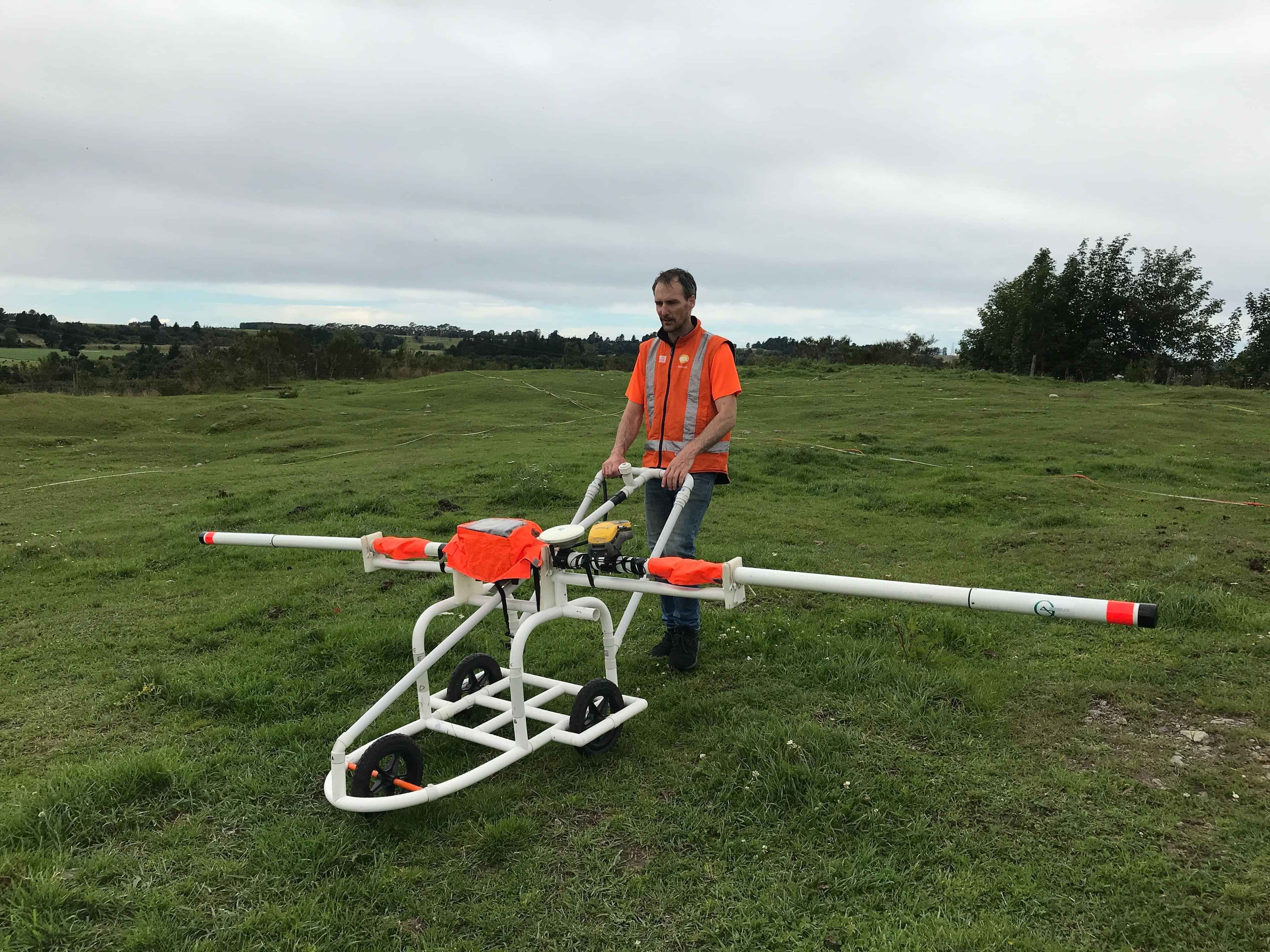
Alongside metal detection, an EM31 also measures the conductivity of the ground by inducing a current and measuring the response. Ground conductivity measurements are excellent for quickly and cost effectively mapping infilled sinkholes (karsts) and locating buried creek beds below proposed developments.
How can we help?
Fill in the contact form below. We respond to all weekday enquiries within 24 hours